


Continental Margins
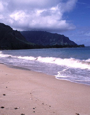 As you begin your journey to the bottom of the ocean, while wearing your experimental suit, your first thought might be that the ground beneath the water near the edge of the shore looks kind of like the land that you just left behind. That is because until you reach the ocean floor, you are traveling on the continental shelf, which is actually part of the land you left above the water.
Believe it or not, the current amounts of seawater on Earth exceed the size of the planet's ocean basins. This excess water floods the edges of the continents. The flooded edge of the continents covered by ocean water is called the continental margin. If you thought the ground looked familiar, that is because you have not really left it yet!
The size of the continental margin changes over time as glaciers melt or refreeze. If glaciers melt, more water is added to the oceans, so the low-lying coasts of continents flood making the continental margin larger and more defined. If colder temperatures cause more water to freeze and glaciers grow, the continental margin will be less defined and smaller as the oceans recede.
Zones in the Continental Margin
 Although the continental margin may have familiar characteristics, it does have some unique features. In this interactivity, you will take a closer look at the different zones that make up the continental margin. Remember to take notes so that you can create the map for your trip. Click the player button to get started.
View a printable version of this interactivity.
Continental Margin Review
![]()
 Now that you have explored the continental margin, review your knowledge in this non-graded interactivity. Follow the directions on each question slide. Click SUBMIT to check your response. Click the player button to begin.