Physical Geography of the U.S. and Canada
Physical Regions of the U.S. and Canada
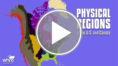
Geographers divide the landmasses of the world into distinct physical regions. These are based on factors like terrain, rock type, landforms, water features, climate, and vegetation. In this interactivity, you will explore major physical regions of the continental United States and Canada. Click the player to begin.
View a printable version of this interactivity or an ADA compliant transcript.
The Great Lakes
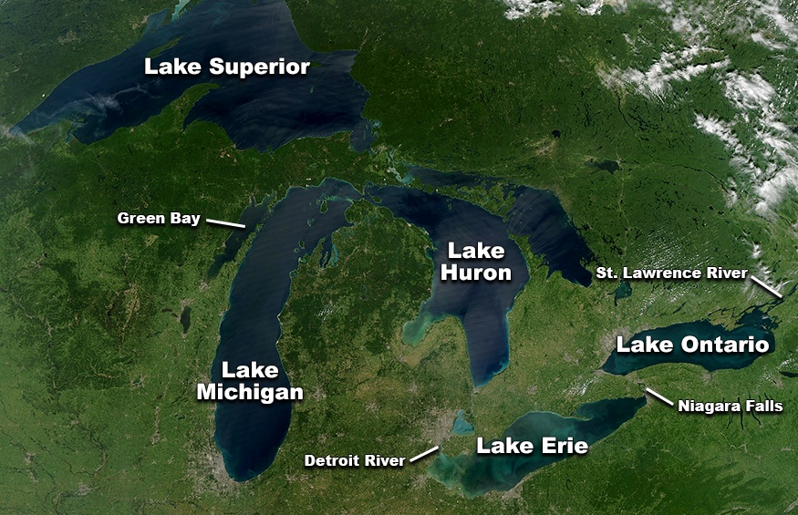
The Great Lakes are among the most well-known water features in North America. They reside on the border between the United States and Canada, at the southern part of the Canadian Shield. The Great Lakes consist of five large freshwater lakes known as Lake Superior, Lake Michigan, Lake Huron, Lake Erie, and Lake Ontario. These lakes hold about 20% of the entire world’s supply of fresh water.
A system of navigable rivers and waterways connect the Great Lakes. This system reaches the Atlantic Ocean via the Saint Lawrence River. Through the construction of canals, the Great Lakes are also accessible from New York City and the Mississippi River. Other major water features connected to the lakes include the Detroit River, Green Bay, and Niagara Falls. Niagara Falls is located on the Niagara River, which connects Lake Erie and Lake Ontario. Compared to other waterfalls, Niagara Falls has the highest flowrate in North America, and the fifth highest flowrate in the world.
Climate Regions
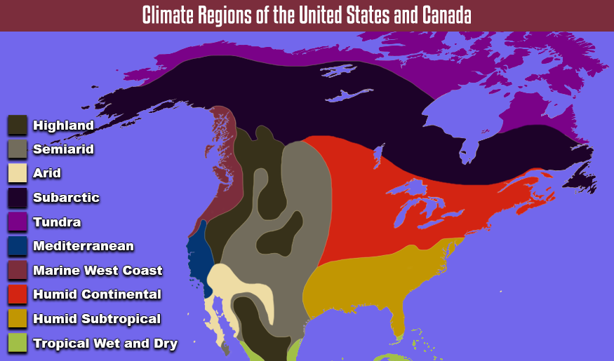
Climate Regions of the United States and Canada: Detailed Description
Together, the continental United States and Canada span several degrees of latitude. It goes from just north of the Tropic of Cancer to north of the Arctic Circle. The U.S. and Canada contain a variety of climate zones as a result of this wide range of latitude.
Water features and landforms also influence the climate in this region. For example, in western United States, warm, moist air blows in from the Pacific Ocean toward the Rocky Mountains. When the air hits the windward side of Rockies, it rises, cooling the air and releasing moisture. Once the air crosses the crest, or topmost ridge, of the mountain range, it is very cool with little moisture left. This creates a rain shadow on the leeward side of the Rockies, resulting in a semiarid climate.
Physical Geography of the U.S. and Canada Review

 Now the you have learned about the major physical regions, landforms, and water features of the United States and Canada, review your knowledge in this interactivity. Click the player to get started.