


Plate Tectonics
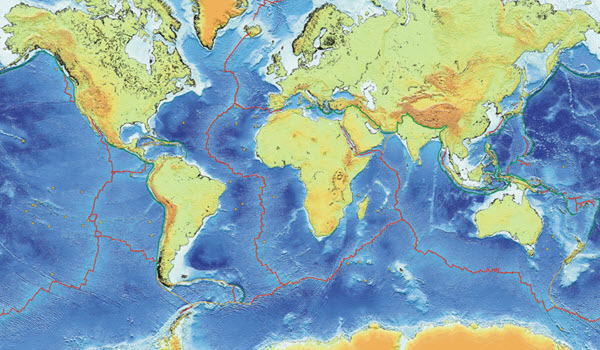 One of the most important roles of the National Oceanic and Atmospheric Administration (NOAA) is monitoring earthquakes deep under the oceans. NOAA scientists with The Ocean Acoustic/Marine Geophysics Project use a global network of highly sensitive, moored autonomous hydrophones that listen for seismic activity. From this global network, scientists compile vast databases of activity, which they plot onto maps to study active areas of the seafloor. These maps allow scientists to view the location of each plate boundary.
How to Complete this Assignment
![]() For this assignment, you will create a map of the world’s plate boundaries. On the map provided, outline and label each of the plates. Download and complete the Plate Boundaries Template. Follow the instructions carefully and submit your completed work to the dropbox.
For this assignment, you will create a map of the world’s plate boundaries. On the map provided, outline and label each of the plates. Download and complete the Plate Boundaries Template. Follow the instructions carefully and submit your completed work to the dropbox.