


Ocean Geomorphology
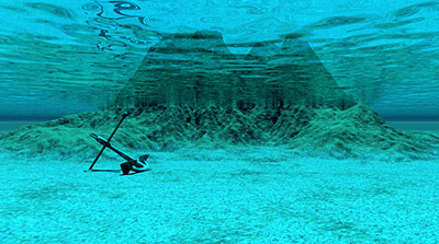 What would the Earth look like if all of the water were removed? It is a difficult task to study below the ocean water. Traveling miles below the surface under extreme pressure is costly and dangerous. In order to study ocean geomorphology, scientists must use a variety of techniques. Sound Navigation and Ranging, better known as SONAR, uses sound to help map the ocean floor. Ships equipped with SONAR technology travel in patterns across the ocean floor in order to produce detailed maps. NASA uses specialized ocean satellites to determine what lies below the ocean surface. Oceanographers will also travel to the depths in submersibles. With all of the different techniques, scientists have identified the main geologic structures found on the ocean floor. The study of how these features form and change is called geomorphology.
Seafloor Features
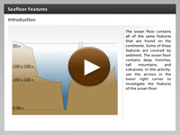 If you swim out into the ocean and touch the bottom below the water, are you touching the ocean floor? Not really. The land on which you live, the continent, extends into the ocean where it is submerged under seawater. This is where you will begin your exploration of the ocean floor. The ocean floor and the continents share many of the same geologic features. In this interactivity, explore the ocean floor and its many features. Click the player button to begin.
View a printable version of the interactivity.
Mid-Ocean Ridges
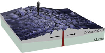 From your study of tectonic activity, you already know that mid-ocean ridges can occur from divergent boundaries on the ocean floor. Until recently, oceanographers did not have the technology to study the geologic features in the middle of the ocean. This area of the world was too deep to study without the use of submersibles. Instead, oceanographers studied the changes in the surface of the ocean. The surface of the ocean mimics the topography below. Once oceanographers were able to travel to the depths, they discovered a system of underwater mountains. These underwater mountains are termed mid-ocean ridges. Their existence provided evidence that the seafloor is spreading.
During a research expedition by the HMS Challenger in the 1870s, the crew discovered a mid-ocean ridge running down the center of the Atlantic Ocean. This ridge runs all the way from the North to the South Pole, making it the world's longest mountain chain. These mountains were created by divergent plates that run down the middle of the Atlantic Ocean. Divergent plates are intersecting tectonic plates that are slowly moving away from one another. As the plates split apart, faulting builds up a ridge on either side of the spreading center. The spreading center is where magma that is pushing up from underground solidifies and forms brand new seafloor. In 1968, the research vessel Glomar Challenger set sail on the Deep Sea Drilling Project: a 15-year mission to collect core samples from the world's oceans. As the oceanographers and other scientists analyzed these samples, they made an important discovery. The sediment layers in the core samples closer to the ridges were thinner and got thicker as the distance increased from the ridges. Scientists can use sediment layers to compare the ages of two or more rock layers. A thick layer of sediment indicates an older igneous rock layer.
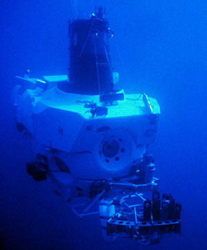
The submersible Alvin carrying sample containers
Despite the evidence, not all scientists were convinced that the ocean floor was getting bigger. In 1970, the submersible Alvin traveled to the center of the Mid-Atlantic Ridge to collect rock samples from the ocean floor. If the seafloor was spreading, then the scientists should find new igneous rock in the center of the ridge. Oceanographers took Alvin deep to the center of the Mid-Atlantic Ridge and found just such volcanic rocks.
Measuring the sediment layer above a rock layer is not the only way to determine the rock's age. Some rocks contain radioactive isotopes which scientists can measure using specialized equipment. Rocks with radioactive isotopes contain atoms that are unstable, meaning they have more neutrons than protons in the nucleus. When this happens, the unstable atoms decay at a constant rate that can be measured. In order to determine the rock's age, oceanographers retrieve a sample of the rock and compare the amount of undecayed material to the amount of new material using a mass spectrometer. After analyzing how much of the radioactive material has decayed, scientists can determine the age of the igneous rock. This is exactly what the oceanographers did with the igneous rock that they collected from the Mid-Atlantic Ridge. The results provided further proof that the ocean floor is spreading and causing the ridges to form as magma pushes up between divergent plates and cools as it comes in contact with the ocean.
Hydrothermal Vents
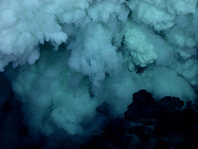
Image courtesy of Submarine Ring of Fire 2006 Exploration, NOAA Vents Program
As oceanographers began to interact with mid-ocean ridges, they discovered something unexpected. In some isolated areas of these ridges, hydrothermal vents form. Scientist believe that these areas may be the places where life began on Earth. As water seeps into the oceanic crust and comes close to a magma chamber, it becomes heated, and then vents out through the crust. This water is often black because it contains various minerals that it picked up underground. For this reason, these vents are often called black smokers.
The heated mineral water makes these vents very special. This water provides the proper temperature for life and also provides nutrients for primary producers that live by chemosynthesis: the process of transforming chemicals into energy. Some primitive bacteria can live in these toxic environments feeding off the dangerous hydrogen sulfide and other minerals that would be deadly to most marine life. Then, other organisms, such as 3-3.5 foot tube worms, consume the bacteria to live and thrive. You might find shrimp, lobsters, giant clams, barnacles, and fish living around hydrothermal vents. These communities live as long as the vent spews hot mineral rich water. When the vent stops, so does life around the vent. Some scientists think that life on our planet could have originated around these hydrothermal vents.
![]() Hydrothermal vents are extremely important to life on the planet; however, you may not see the connection between a volcano deep below the Earth’s surface and living organisms on a continent. With the use of satellites, oceanographers from NASA have determined that hydrothermal vents help fuel phytoplankton blooms and provide nutrients to ocean organisms. The same phytoplankton removes carbon dioxide from the atmosphere. View Nutrients from Deep-Sea Vents from eMediaVA℠ to learn more about the study of hydrothermal vents.
Hydrothermal vents are extremely important to life on the planet; however, you may not see the connection between a volcano deep below the Earth’s surface and living organisms on a continent. With the use of satellites, oceanographers from NASA have determined that hydrothermal vents help fuel phytoplankton blooms and provide nutrients to ocean organisms. The same phytoplankton removes carbon dioxide from the atmosphere. View Nutrients from Deep-Sea Vents from eMediaVA℠ to learn more about the study of hydrothermal vents.
Submergent and Convergent Coasts
Coastal features are constantly forming and changing through two ocean-powered processes, erosion and deposition. Coastlines are either the result of erosion or deposition. The coastlines of the United States include both types. The Eastern Coast of the United States is a submergent coast, known for its sandy beaches. This coast is the result of deposition. The Western Coast of the United States is an emergent coast. This coast is rocky and erosion is constantly taking place.
Emergent Coastlines
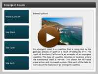 An emergent coast is a coastline that is rising due to the geologic process of uplift or a result of falling sea level. The coast of Northern California is an example of an emergent coastline. This type of coastline develops in locations where the continental shelf is narrow. This allows for increased wave action and increased erosion. Click each of the tabs to learn about the features of an emergent coastline. Click the player button to begin.
View a printable version of the interactivity.
Submergent Coastlines
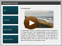 A submergent coast is a sinking coastline due to subsidence or rising sea level. The Chesapeake Bay is one area that is currently a submergent coastline. These coastal features are formed by the process of deposition, or the layering of sediment transported from elsewhere by wind and water. In this interactivity, click on each of the tabs to learn more about the features of submergent coasts. Click the player button to begin.
View a printable version of the interactivity.
Methods to Reduce Erosion
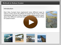 Humans love to live near water, and the majority of the world’s population lives near the ever-changing coastlines. You know that erosion and deposition are natural processes that will continue to occur no matter what, but it is difficult to understand when your home and community are a part of this changing landscape. Over time, humans have engineered many different ways to reduce or slow down the effects of erosion by the ocean. In this interactivity, learn about the different methods used to reduce the effects of coastal erosion. Click the player button to begin.
View a printable version of the interactivity.
Ocean Geomorphology Review
![]()
 Now that you have explored ocean geomorphology, review your knowledge. In the non-graded activity, drag the descriptions on the right and drop them next to the correct vocabulary terms on the left. Click the player button to get started.