


Interpreting Weather Maps
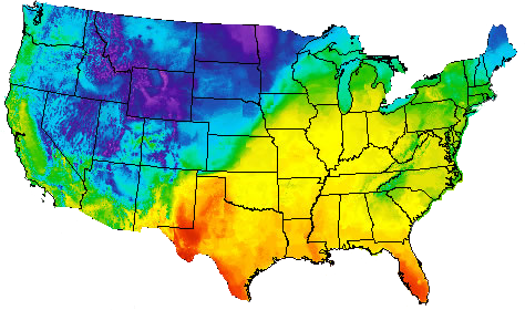
A weather map showing air temperatures for the United States
Weather data is often communicated through weather maps. Weather maps can focus on one specific type of data, such as temperature or wind speed. Weather maps may contain several types of data displayed on the same map. Station models are one way to communicate a variety of weather data in one place for certain locations, while other maps focus on presenting temperature, air pressure, precipitation, or other categories of weather data.
![]() Did you keep your sketch of the symbol you created in this topic’s Warm-Up activity? If so, review the information that you included on it. Consider how this symbol differed from the station model you learn about in this topic.
Did you keep your sketch of the symbol you created in this topic’s Warm-Up activity? If so, review the information that you included on it. Consider how this symbol differed from the station model you learn about in this topic.