


Early Christian Oceanography
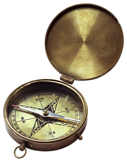
Build a Working Compass Challenge
Imagine how amazed early explorers and navigators must've been the first time they used the newly invented magnetic compass to help find their way through the open ocean waters! Now, consider the challenge presented to early cartographers who used the magnetic compass for creating maps and charts for these explorers and navigators.
 In this assignment, your challenge is to first make a simple magnetic compass, and then to use this compass to help create a map route leading to a specific location, whether at school, in your town, or part of your neighborhood. Finally, you'll invite a volunteer to navigate from a starting point to a finishing point simply by using the compass you made and following your map route.
For this activity, you'll need a digital camera or video recorder to document making your compass and map. You will also need a volunteer (a fellow classmate, a family member, or a friend) to use your compass and the map you create.
Part 1: Make Your Own Magnetic Compass
Download the Make Your Own Compass (PDF) instructions from NOAA. Carefully follow the instructions and test to ensure your compass works before continuing to Part 2.
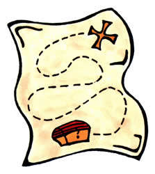
Part 2: Sketch Your Map Route
Be creative! You'll now play the part of a cartographer and use your new compass to help plot a map route directing someone from a designated starting location to a secret treasure or somewhere at school, in your town, or part of your neighborhood.
First, decide where you want your reader to go. Use good judgment, and choose a safe, public location. Indicate this location on your map with an 'X'. Then, choose a starting location and indicate this with a circle.
Next, decide how you want to indicate distance to travel on your map. A good idea is to use paces or steps, or you may use specific distances such as feet.
 You'll now begin plotting the course for your map. At your starting location, face in the direction you want to go first. Place your compass on a stable surface or the ground and read the direction in which the needle points. This will be magnetic north. The direction you indicate on your map is made by interpreting the direction you're facing relative to the direction in which the needle is pointing. For example, if when looking at the compass the needle points to your left (indicating magnetic north), then the direction you are facing is east. If the needle faces backward towards you, then you are facing south. Make your compass reading and note the appropriate starting direction on your map.
You will then count out the paces or steps to another logical point along the route toward the destination. For example, you could count out 50 paces in the first direction; stop, turn, and take another compass reading; then proceed another 20 paces in the new direction. How complex you choose to make your map is up to you, but keep in mind that the goal is to lead the reader to their destination safely, and in a reasonable amount of time. Recall that ancient navigators used a technique called piloting. Could you also use this method in your map route to help guide your volunteer?
Continue the process of choosing a direction in which to travel, taking a careful compass reading, counting out paces, stopping, and taking another compass reading in a new direction until you reach your destination.
You should end up with a listing of coordinates like this example:
- Start (indicated by a circle)
- Turn east and walk 50 paces
- Turn south and walk 20 paces
- Turn east and walk 35 paces
- Turn south and walk 15 paces
- Turn north and walk 80 paces
- Turn east and walk 100 paces
- Finish (indicated by an 'X')
Part 3: Test Your Compass and Map Route
Now let's see how your skills as a cartographer can help someone find the destination using just your compass and the map route you created.
Explain to your volunteer how to use your compass and how to read your map route. Observe their journey as they try to navigate to the secret location on your map. Try not to give them any hints as to the location, but do stay alert along the way for any potential trouble spots or hazards. Remember, safety first!
How to Complete this Assignment
![]() Your map may be as creative as you like it to be, but it must include the basic route directions necessary to lead a volunteer from a designated starting location (indicated by a circle) to a finishing point indicated by an 'X'. Use this checklist to make sure that you've included the required documents for this assignment. Submit your map route as a scanned document, image, or computer-generated document using the software of your choice.
Your map may be as creative as you like it to be, but it must include the basic route directions necessary to lead a volunteer from a designated starting location (indicated by a circle) to a finishing point indicated by an 'X'. Use this checklist to make sure that you've included the required documents for this assignment. Submit your map route as a scanned document, image, or computer-generated document using the software of your choice.
After your volunteer completes his or her journey, write one paragraph addressing the following questions:
- How accurate was your compass in indicating directions while you created your map? Where was your finishing location? What was your volunteer supposed to find?
- How successful was your volunteer in using your map and compass to find the location you indicated?
- Did your volunteer indicate any missing or inaccurate information along the way? What could've made the process better for you and/or your volunteer?
- What challenges do you think early navigators had in using compasses like the one you made to create their maps?
Include photos of your working compass. You may opt to include any photos of your volunteer using your map route and compass. Please submit your work to the dropbox.